
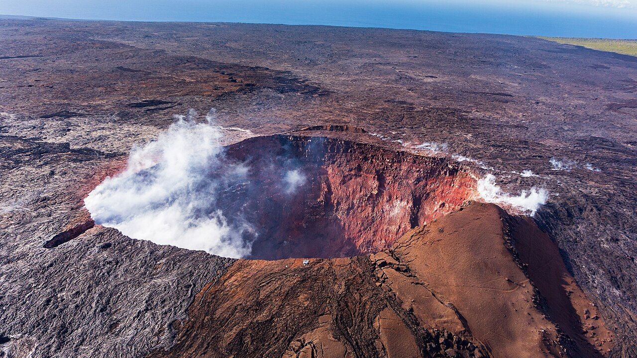
1. What does the summit set in motion?
Morning at Kīlauea starts with a landscape that refuses to keep its story in one place. The volcano occupies the southeastern flank of much larger Mauna Loa, but its eruptions reach far beyond the summit.
During long stretches of the last two centuries, activity has broken out along the summit or the rift zones: cracked belts extending east and southwest from the caldera.
2. What was remembered before it was measured?
Hawaiian oral history preserves accounts of Kīlauea from before written records. Around 1790, an explosive summit eruption killed a group of people crossing the area, including warriors of chief Keōua; it remains the volcano’s most deadly known event.
Ash in the southwest of the park still holds footprints from that time. They’re a quiet trace, and the scale of the loss behind them makes this a part of the story I don’t want to turn into scenery.
In 1912, a volcano observatory was established on the caldera rim, bringing scientific watching into a more sustained rhythm. Swelling, earthquakes and gas changes have been measured and recorded since then, and much of what’s understood about basalt volcanoes was learned here.
3. What does the crater remember?
Visitors once came from around the world to see the lava lake that often moved inside Halemaʻumaʻu. In 1924, explosions sent large rocks out of the crater and left it much wider than before.
Then, in 1959, fountains of lava at Kīlauea Iki climbed hundreds of meters into the air, filling the crater with a lava lake. Its surface cooled, and now the Kīlauea Iki trail crosses that surface; for a walk where the older event stays right underfoot, it’s a favorite of mine.
4. How did the east rift carry lava to the coast?
By January 1983, the story had moved into forest well below the summit, where an eruption began on Kīlauea’s east rift zone. A cone called Puʻu ʻŌʻō formed there, and the eruption carried on for about thirty-five years, among the longest in recorded history.
Over those decades, lava made its way coastward both through tubes and across the open surface, spreading over large parts of the south flank.

In 1990, lava destroyed Kalapana and filled Kaimū Bay, including its well-known black sand beach. The coastal highway and old Chain of Craters Road lost sections beneath flows, while lava entering the sea built many hectares of new land. I’m especially taken with the lower Chain of Craters Road, where glassy flows make the long rift story visible.
Read next: What changes on the road down to the sea?
For visitors, ocean entry became a famous sight during these years, though viewing conditions and rules changed often. The coast was never just a distant finish line for the eruption; it was where the land kept gaining ground.
5. What shifted in lower Puna?
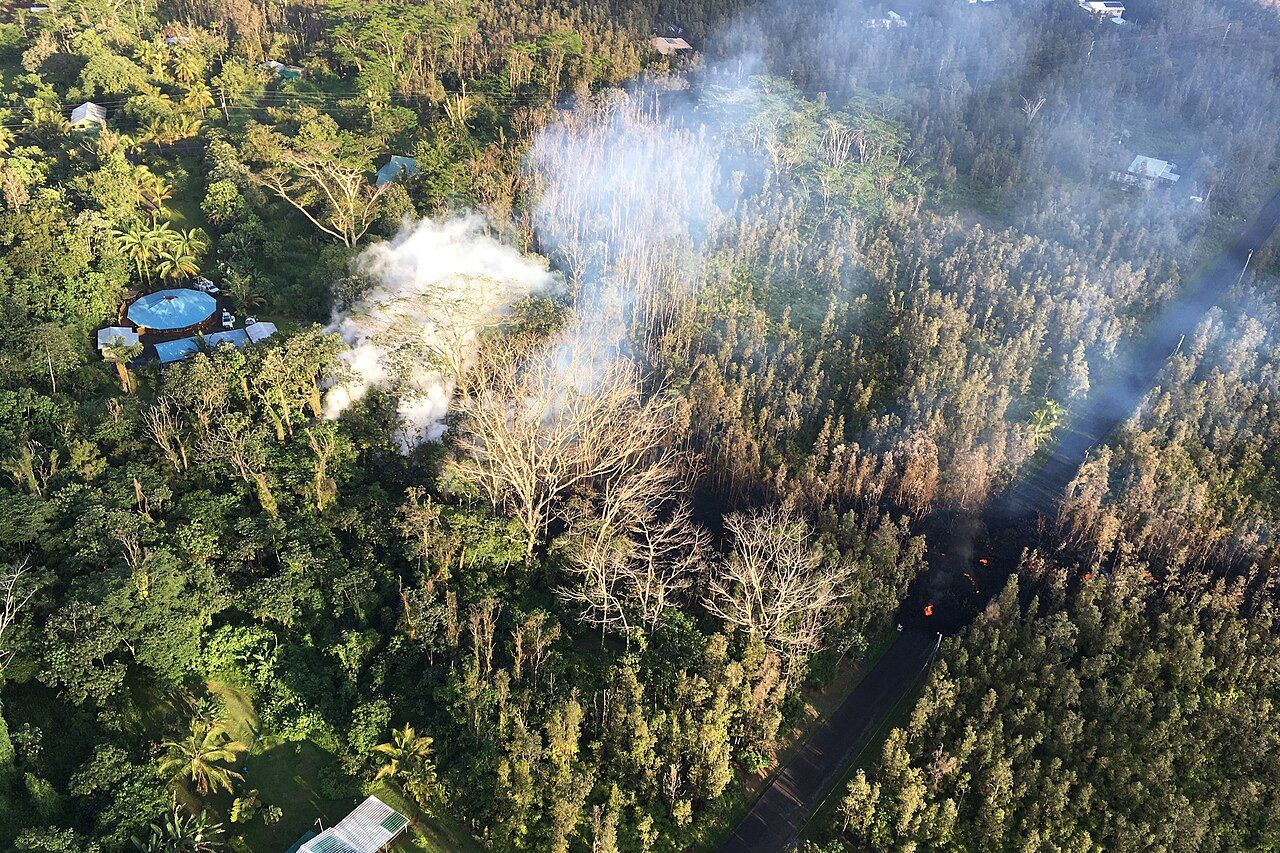
Late April and early May 2018 brought a sudden change of direction: Puʻu ʻŌʻō’s floor collapsed, magma traveled down the east rift, and fissures opened in Leilani Estates on 3 May.
More than twenty fissures erupted over the months that followed. Lava crossed neighborhoods and farmland on its way to the sea, destroying hundreds of homes, filling Kapoho Bay and reshaping a large stretch of coastline.
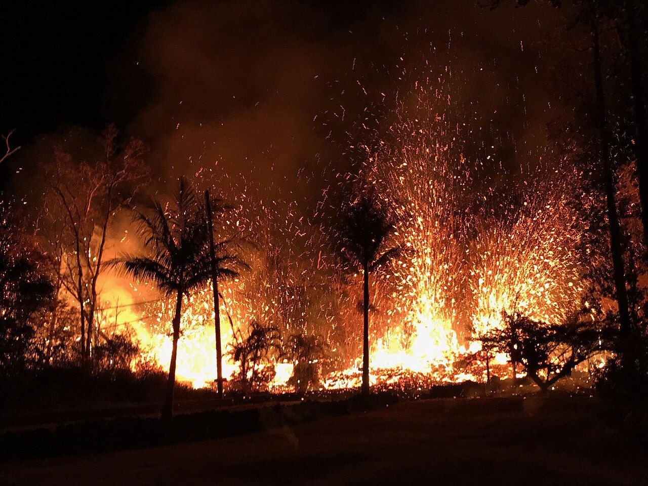

That eruption ended in early September 2018, but the story doesn’t end neatly with the last activity. For families in Puna, the loss of homes and land is recent and personal, not a distant chapter to admire from the rim.
6. Why did the summit floor drop?
As magma drained from beneath the summit, the ground above it began sinking. Through the summer, Halemaʻumaʻu and much of the caldera floor descended in repeated collapses, each one felt as an earthquake.
By the end, the crater had deepened by hundreds of meters, and the summit area looked profoundly different. Roads, trails and buildings were damaged, while some places closed for good. The scale of that change is part of what I find so striking about the Puna coast: the summit and rift are chapters of one restless system.
7. What began after the collapse?
In 2019, a small body of water appeared at the bottom of the deepened Halemaʻumaʻu and slowly grew. Water hadn’t been seen there before in recorded history, making the quiet lake an unexpected new turn.
That changed in December 2020, when a new eruption began inside the crater. The water boiled away within hours, and a lava lake took its place. Since then, activity has mostly stayed around the summit, with eruptions inside Halemaʻumaʻu and the caldera, plus occasional brief activity elsewhere.
Some summit eruptions have gone on for months; others have arrived as short episodes with high fountains, followed by pauses. Mauna Loa erupted in late 2022 for the first time since 1984, with flows heading away from towns. For the shape of the summit today, start with Kīlauea's summit caldera.
8. What stays in view by evening?
Across the park, different surfaces hold different chapters: fresh, glassy flows beside the lower Chain of Craters Road belong to the long east rift years, while the sunken caldera floor speaks to 2018.
Kīlauea Iki’s smooth floor points back to 1959, with older layers beneath it reaching many thousands of years into the past. Hawaiian tradition carries its own understanding of these events, centered on Pele and her family; I like having both ways of reading the land in view.
What can go in the margin?
- The volcano observatory on the caldera rim dates to 1912.
- The Kīlauea Iki trail crosses the cooled surface of a lava lake.
- The lower Chain of Craters Road passes flows from the east rift years.
- For the story of Pele and place, continue with Pele, place and respect.