
1. Why does the mountain seem so low?
Morning is a good time to begin on the Kīlauea side of the park, where Mauna Loa Road leaves Highway 11 just west of the entrance. The drive takes around forty minutes from Volcano village, though the road itself deserves more attention than a clock.
From much of the island, Mauna Loa looks like a long, low ridge, its top often lost in cloud. Then the road starts climbing, and the scale sneaks up on you: this is the largest volcano on Earth by volume, and its slopes cover about half of Hawaiʻi Island.
The route climbs for more than ten miles, from roughly 4,000 feet toward the high flank. I like this quieter approach to the mountain; Kīlauea’s summit crowds seem far off, even though that’s where the day begins.
2. What’s tucked into the lower forest?
Near the bottom sits Kīpukapuaulu, a kīpuka: older land left as an island when younger lava flows passed around it. The spared ground has deep soil and old forest, with tall koa and ʻōhiʻa trees over a thick understory of native plants.
A loop of about a mile threads through the kīpuka, and this is my favorite walk on the drive. The birds are easier to hear than spot, so a slow pace suits the place better than hurrying along to tick off the loop. There’s more about ʻōhiʻa, ferns and forest birds here.
After the forest, the road narrows and winds uphill through open woodland. That shift makes the climb feel gradual at first, as the trees thin and the mountain begins taking up more of the day.
3. How does the road change above the trees?
Higher up, the road pinches to a single lane, with occasional passing places and tight bends. It’s a road for taking slowly, sounding the horn around blind corners when needed, and letting other vehicles pass where there’s room.
Nēnē sometimes appear along the verges; they’re the Hawaiian goose, and the right response is to give them space and not feed them. There’s no need to make the drive busier than it is.
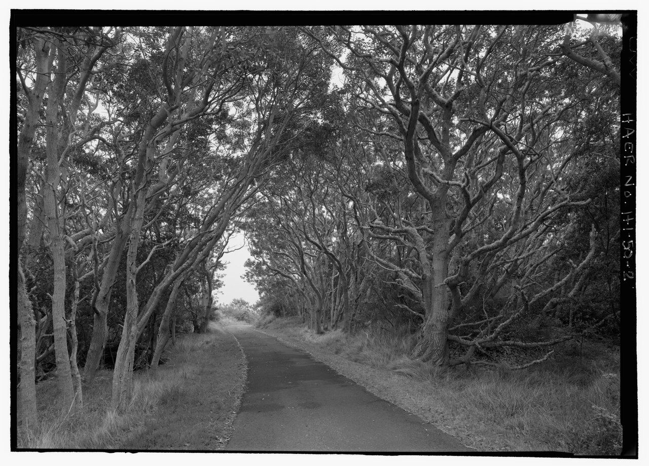
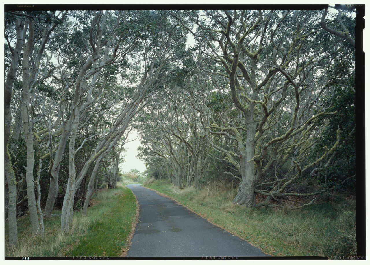
Old survey photographs show a strip of pavement beneath leaning, gnarled trees, grass along the edges. The road was surveyed and photographed as a historic record, and the view today still has that same spare, tucked-under-the-branches feeling.
As the trees grow smaller and farther apart, the views open behind them. On a clear morning, Kīlauea’s summit and rising steam come into view, with the coast beyond; it’s a lovely reversal, looking back over the place the climb left behind.
Read next: Kīlauea’s summit, from the rim inward
4. What waits at the end of the road?
The road ends at a small parking area and lookout, roughly 6,600 feet above sea level. Scrub and bare lava replace the forest, while Mauna Loa’s broad, gentle slope rises above, reaching toward a summit more than a mile higher.
On clear days, the view reaches across the Kaʻū district to the south and back toward Kīlauea. Native Hawaiians regard Mauna Loa’s high reaches as sacred, and the mountain’s quiet scale makes a quiet pause feel right.
This is also the start of the long summit trail, but it’s not a casual extension of the drive. The route is a serious, multi-day trek through cold, exposed country with no water; it requires planning, a permit, and experience. For most of us, the lookout is plenty.
5. What does the mountain’s recent history add?
Mauna Loa erupted in late 2022, its first eruption since 1984. Fissures opened near the summit, then along the northeast rift zone on the far side from this road, with lava flowing toward the highway across the saddle between Mauna Loa and Mauna Kea.
For a couple of weeks, the glow lit the night sky across much of the island before the eruption stopped. That history sits oddly beside the quiet road and open slopes, a reminder that the mountain’s calm appearance isn’t the whole story. Read a short history of the eruptions, or look toward Mauna Kea across the saddle.
6. How does the day wind down?
At the lookout, the air is cooler than down in Hilo or along the coast, and the wind can feel sharp. Some people feel short of breath or light-headed if they walk briskly at this height; I’d rather stand still and take in the broad sweep of the mountain.
Cloud often builds over the slopes by afternoon, so the morning views may give way to a more closed-in descent. The upper road is unlit, and the drive is better finished before dark; coming down slowly is part of the day, not an afterthought.
- The drive, lookout, and Kīpukapuaulu walk take two to three hours.
- Bring a warm jacket, water, and binoculars; there’s no fuel, food, or water on the road.
- Start with a full tank, and allow around forty minutes to reach the road from Volcano village.
- The lookout is about 6,600 feet; the road climbs from roughly 4,000 feet.
For another park story, take a look at the account of Kīlauea’s caldera.