
1. What does the road feel like in the morning?
From Volcano village, Highway 11 carries the day southwest through Kaʻū, past Punaluʻu and Nāʻālehu, until South Point Road turns toward the sea. The drive takes about 90 minutes, and mornings tend to bring the calmer stretch of weather.
Kaʻū lies between the national park and the Kona side, a wide mix of ranch land, lava, and coastline where few people live. The road across the pasture is narrow and paved, about 19 kilometers (12 miles) long, and in places two cars have little room to spare. There’s a particular quiet to this drive: the open country keeps widening, and the usual signs of a busy island day fall away.
I like taking this road slowly. The land isn’t rushing toward a big reveal so much as getting emptier by degrees, with the coast waiting somewhere beyond the pasture.
2. What moves across the pasture?
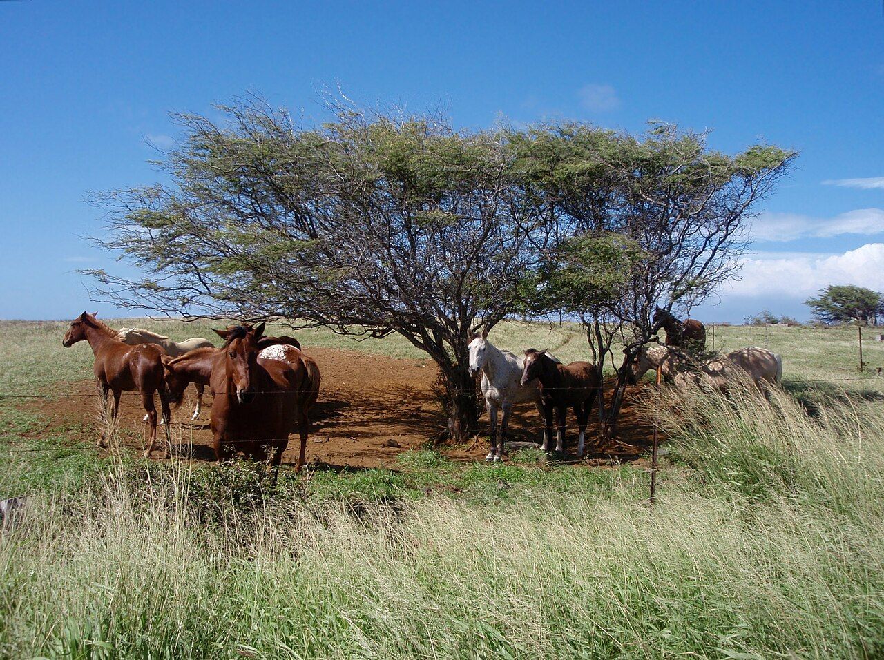
Wind has its say well before the road reaches the water. Trees are bent toward one side, turbines turn on the slope, and cattle and horses graze in the fields; the whole view seems to lean with the gusts.

Keep the car moving at an easy pace, since animals can be on the road and faster local traffic may come up behind. Near the end, the pavement branches: one way drops toward Ka Lae, the other points toward the beginning of the Papakōlea walk. Signs are sparse in places, and phone signal can be unreliable, so having a map downloaded before leaving the highway makes sense.
3. What does the island’s edge look like?
Ka Lae is where Hawaiʻi Island reaches its southernmost point, and it’s also the farthest-south point in the fifty states. No mountain towers over the scene. Instead, the grassy plateau ends at dark cliffs, with deep blue water below and wind moving across the exposed ground.
Currents converge offshore, and the waters have supported fishing for centuries. Along the rocky rim, holes shaped by wear once served to secure canoes, so fishers could work the water without being swept away. Archaeologists regard the area as among the islands’ earliest settled places, and the wider point has historic landmark protection.
A heiau, or stone temple platform, stands near the tip. It’s worth looking at from beyond its walls, leaving the stones where they are and off the platform. This is deep-history country for Hawaiians as well as a working fishing ground; a quiet visit, with space left for fishers, suits it better than treating the point like a stage.
Read next: Punaluʻu: black sand and resting honu in Kaʻū
There may be people leaping from a ledge into the sea and climbing back up by ladder. The drop is high, the currents below are powerful, and rescue is far away, so watching from shore is enough for me. Looking south, there’s open ocean for thousands of kilometers; it’s easy to feel the scale of the waters and currents Hawaiian voyagers learned to read.
Keep well back from the cliff edges. The rock can be undercut, gusts arrive without warning, and the swell below can pull even a strong swimmer out to sea. The wind is the thing I remember most here: constant, insistent, and impossible to mistake for a gentle breeze.
4. How much walking is there to Papakōlea?
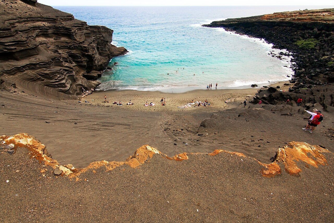
A few kilometers northeast of Ka Lae, Papakōlea sits within the worn-down remains of an old cinder cone. Olivine, a green mineral formed in lava, gathered there as the cone eroded, giving the beach sand its olive cast. It’s one of the world’s few green sand beaches, but reaching it takes more than a quick turn off the road.
The coastal track is rough, exposed, and around 4 to 5 kilometers each way, with steady wind and no shade. The round trip takes a couple of hours, with beach time on top. The final way down into the cove is a steep scramble over loose ground, and all the water for the walk needs to come along.
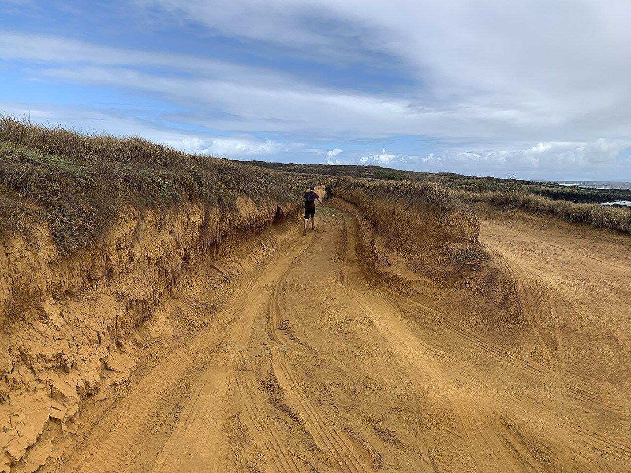

Vehicle tracks along the coast have cut deep ruts into the land and damaged archaeological sites scattered through the area. I’d rather make the walk than add to those scars. The green grains belong on the beach, where a very long time went into gathering them.
5. What does the return drive bring?
On the way back toward Volcano, Kaʻū keeps offering little pieces of its working landscape: coffee and macadamia trees on slopes above the highway, small churches, and ranch gates beside the road. Nāʻālehu is the main settlement, with a few basic services, while much of the coast below remains mostly untouched.
A stop for the turtles at Punaluʻu fits on the drive back toward Volcano. Then the highway climbs toward the park, and the country turns green again. By late afternoon, Kīlauea's summit caldera may be edged with cool mist, a striking change after the heat and wind at Ka Lae.
The island’s distances are part of the day, not just the miles between stops; there’s more on driving around the island.
6. What belongs in the car?
- Pack a windproof layer, water, a sun hat, sturdy shoes, and snacks.
- There’s no shade on the coast, so sunscreen and sunglasses belong in the day’s kit.
- Fuel stations are few in Kaʻū; fill up before leaving Volcano or in the larger towns.
- Don’t leave anything in plain view inside the car.
- At the cliffs, keep well away from the edge, where rock can be undercut and gusts unpredictable.
Ka Lae is my kind of island edge: open, windy, and far more compelling than a polished viewpoint.