
1. What can the rim show you?
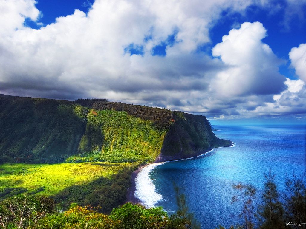
Does a valley need a path through it to make an impression? At Waipiʻo, the view from the edge tells plenty: a broad plain sits far below, hemmed in by green walls that reach the sea.
At the mouth, black sand curves along the shore beneath white surf. The northeast side of Hawaiʻi Island has several valleys, and this is the largest of them; from here, its scale comes through without stepping down into it.
The road reaches its end at Kukuihaele, where a small parking area lies beside the cliff. A few steps bring the whole scene into view, and I like that the first encounter asks for looking, not access.
2. How did the land take this shape?
Waipiʻo runs several kilometres into Kohala, the island’s oldest volcano. Streams and heavy rain did the slow work of cutting the valley, leaving a level, fertile floor of wetland and fields beneath steep slopes.
Rain can send waterfalls down the rear walls, including the long, narrow Hiʻilawe. From the rim, though, those falls may be out of sight; the valley gives no promise that every detail will appear from one viewpoint.
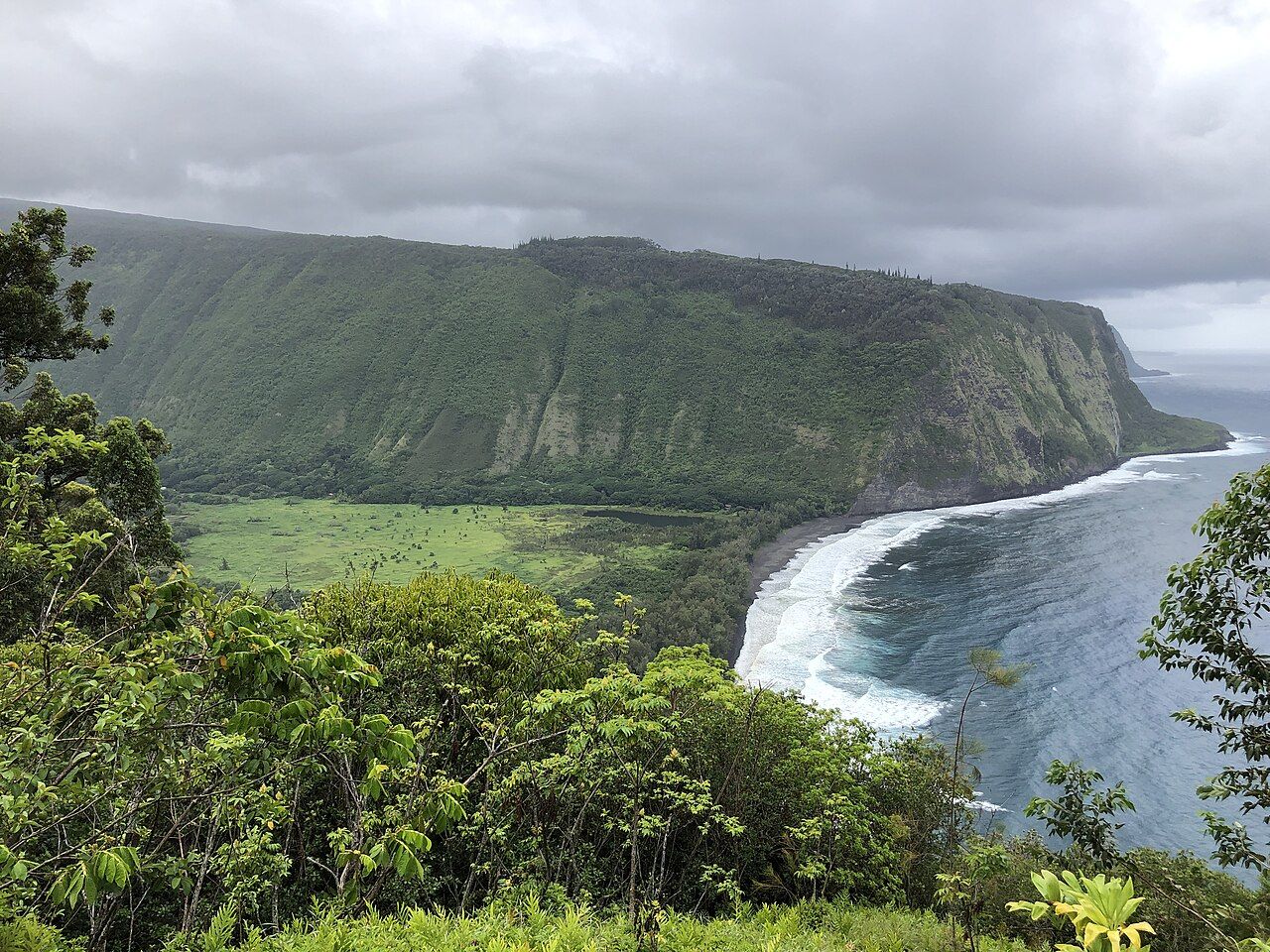

Across the open space, a trail zigzags up the opposite face. Past that rise are more deep valleys along the Kohala coast, with no roads running through them. The beach faces open ocean, where the surf can be powerful.
3. What does the name carry?
Waipiʻo means curved water. The name is a small doorway into a history much larger than the view, because the valley has held a central place in Hawaiian life and memory.
Aliʻi, the chiefs, lived here, and the valley is tied to the young Kamehameha, who later united the islands. It is also remembered for its mana, its spiritual power; burial places and sacred sites are spread through the land.
The twentieth century brought severe disruption. A tsunami in 1946 pushed far across the valley floor, and floods came in later years. Many families left for the plateau or moved away, so the community below is small today.
Those who remain have lived through plenty of change arriving by that steep road. From above, the fields and water can look like a scene apart from the rest of the island, but this is a lived-in place with a long memory.
4. Can you make out the fields?
Look toward the flat land and the floor may resolve into a patchwork of loʻi: flooded terraces where kalo, or taro, grows. Poi is made from kalo, which Hawaiian tradition names as the elder brother of the Hawaiian people.
Families have tended these plots for generations, and Waipiʻo remains among the island’s important places for growing taro. The water and soil aren’t just part of the scenery; they’re part of work and family life here.
That distinction matters when people think about going down. Homes, fields, and private land make up the valley floor, and visitors have driven through growing areas, crossed property, and left rubbish behind. A view from the rim leaves room for the people below to carry on with their day.
Read next: Rainbow Falls and ʻAkaka Falls, where Hilo’s water goes
5. Why is the road limited?
One narrow road descends from the lookout, winding steeply all the way to the floor. It’s among the steepest roads of its length in the country, and its grades put four-wheel-drive vehicles to a test while wearing down brakes on the descent.
Rockfalls and damage to the road have added to the difficulty. In recent years, Hawaiʻi County has restricted access for safety, leaving passage mainly to residents, farmers, and others with a reason to be there.
Walking down doesn’t turn the trip into a simple alternative. The climb back is strenuous in heat and humidity, much of the land beyond the road is private, and streams across the floor can rise quickly after rain upstream.
The basic arrangement is clear: the lookout is open to everyone, while the floor is a community. Unless there’s a clear, current right to enter, the view from above is the right visit. I’d take that wide, quiet prospect over a walk that doesn’t belong to me.
6. What’s worth noticing at the lookout?
Parking is limited, and the lot sits close to homes. A full space isn’t a reason to leave a car in the road or across a resident’s driveway; patience belongs in the plan as much as the drive does.
Stay behind the rail, since the cliff edge is unstable. Keep voices low, take rubbish away, and leave drones out of the air above the valley and its homes.
Morning usually gives the clearest views before clouds gather on the windward slopes. Rain has its own drama, turning the walls silver with falling water. I’m partial to the rain-washed cliffs, even if the valley’s shape is easier to read when cloud gives it space.
7. How does the road fit into the day?
From Hilo, Highway 19 follows the Hāmākua coast north to Honokaʻa. Highway 240 then runs toward Kukuihaele and the lookout; allow about 75 minutes from Hilo, with extra time if the road includes stops.
From Volcano village, the drive down to Hilo comes first, so the day is longer. Rainbow Falls and ʻAkaka Falls are close to the route, and Honokaʻa is another place to pause along the way. The notes on driving around the island put this stretch into the larger island loop.
What belongs in the margin?
- Route: Highway 19 north, then Highway 240 to Kukuihaele.
- From Hilo: about 75 minutes by car.
- Bring a light rain jacket, binoculars, and water; allow patience for limited parking.
- The lookout sits on a clifftop about 300 metres up.
- The valley floor is home to families, not a public walking area.
8. What does this view ask of us?
Waipiʻo is a useful reminder that the island isn’t scenery waiting to be crossed. From volcanic ground to the coast, there are homes, work, and places with histories that don’t pause for a visitor’s itinerary.
That thought extends beyond this valley, and the story of Pele, place and respect follows it through other parts of the island. Waipiʻo’s rim remains one of my favorite places to stand and look, precisely because the valley below can remain itself.