
1. What does the bay tell you about Hilo?
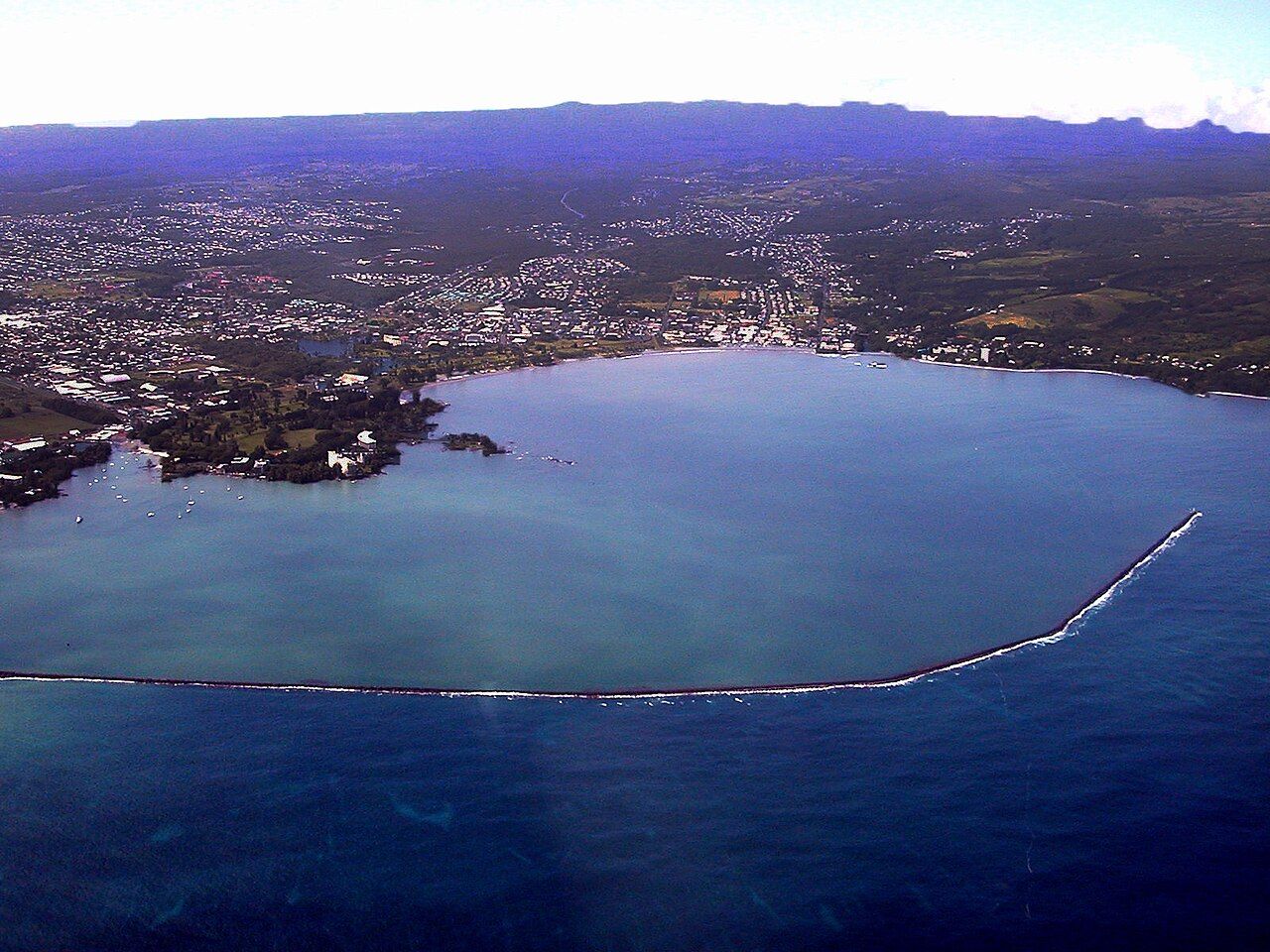
What sort of town grows around a broad bay, with mountains at its back and the Pacific at its front? Hilo is Hawaiʻi Island’s largest town, the main center of the wet eastern side, and a place where the water belongs to daily life.
Mauna Kea and Mauna Loa rise behind the town, while rivers come down from the uplands and a breakwater reaches across the bay’s entrance. Along the shore, wooden and concrete storefronts face the water. Hilo isn’t arranged like a resort; it’s a working town, where people live, shop, work and go to school at an unhurried pace.
From volcano country, it’s the nearest town of any size, just under an hour down Highway 11. The change is striking without needing a grand plan: forest and lava give way to streets, gardens, markets and the open curve of the bay.
2. How does the rain shape the day?
Trade winds bring moisture from the northeast, then rise against the mountains behind town and release it. Hilo is among the wettest towns in the United States; showers pass through during the day and often grow heavier in the afternoon and at night.
Mornings are frequently clear, with Mauna Kea sometimes visible above the clouds. Rain fills the rivers, feeds flowers in the gardens and lets moss and ferns take hold on walls and roofs. That green feels less like decoration than the ordinary result of living here.
Umbrellas are common, though plenty of people simply accept getting a little wet. A light rain jacket and sandals or quick-drying shoes suit the damp, and indoor stops can take the edge off a wetter stretch. The notes on rain and what to pack fill in the island’s weather picture.
3. Where does town life meet the water?
Downtown traces the bay’s curve, and the older buildings give its streets much of their character. Covered walkways, tall windows and painted wooden fronts remain from the years when sugar and shipping brought activity through town.
Those buildings now hold local shops, galleries and offices. Along the opposite side of the road, lawns and trees make a long green strip beside the bay, with the breakwater in view. There’s a pleasant everyday feel to this waterfront; it belongs to the town, not to a separate visitor district.
Across the bay, low land along the shore has stayed open rather than being filled again with houses. That decision makes more sense when the bay’s history comes into view, and the parks feel like more than a pretty frame around the water.
4. What happened along Hilo’s shore?
Hilo Bay opens northeast toward waves generated by earthquakes around the Pacific rim, and its shape directs those waves toward town. Two tsunamis in the twentieth century brought devastating losses here.
On 1 April 1946, waves from an earthquake near the Aleutian Islands reached the island without warning. They destroyed Hilo’s waterfront and many lives were lost. On 23 May 1960, a tsunami caused by a great earthquake in Chile arrived hours after a warning had gone out.
Some people didn’t evacuate, while others returned before it was safe; the waves killed dozens and wrecked large parts of the low-lying town. Hilo didn’t rebuild in its most exposed areas. Much of the former waterfront became parks and open space instead.
Rather than rebuild in the most exposed areas, Hilo turned much of its old waterfront into parks and open space.
Rather than rebuild in the most exposed areas, Hilo turned much of its old waterfront into parks and open space.
The lawns and trees now stand as a living memorial as well as a practical defense. Downtown, the Pacific Tsunami Museum uses photographs, objects and survivors’ words to tell what happened and explain how warning systems work now.
Near the coast, sirens, a strong earthquake or a sea that suddenly draws back are reasons to head inland and uphill at once. Follow official instructions and stay away until authorities say it’s safe.
Read next: Puna’s coast, reshaped by lava
5. Why spend time in Liliʻuokalani Gardens?
On the bay’s eastern side, Liliʻuokalani Gardens offers ponds, arched bridges, stone lanterns and carefully shaped trees in a Japanese style. The park was created during the century’s opening years and named for Queen Liliʻuokalani, the last reigning monarch of the Hawaiian Kingdom.
It also honors Japanese immigrants who came to work on the island’s sugar plantations and helped shape Hilo’s culture. The park’s details are lovely on their own, but that history gives the place a deeper connection to the town around it.
Paths follow the shoreline and cross small bridges between ponds, opening views across the bay toward town and the mountains. I’m fond of how easily a walk can wander between water, trees and those carefully tended corners, without turning into a march from one attraction to the next.
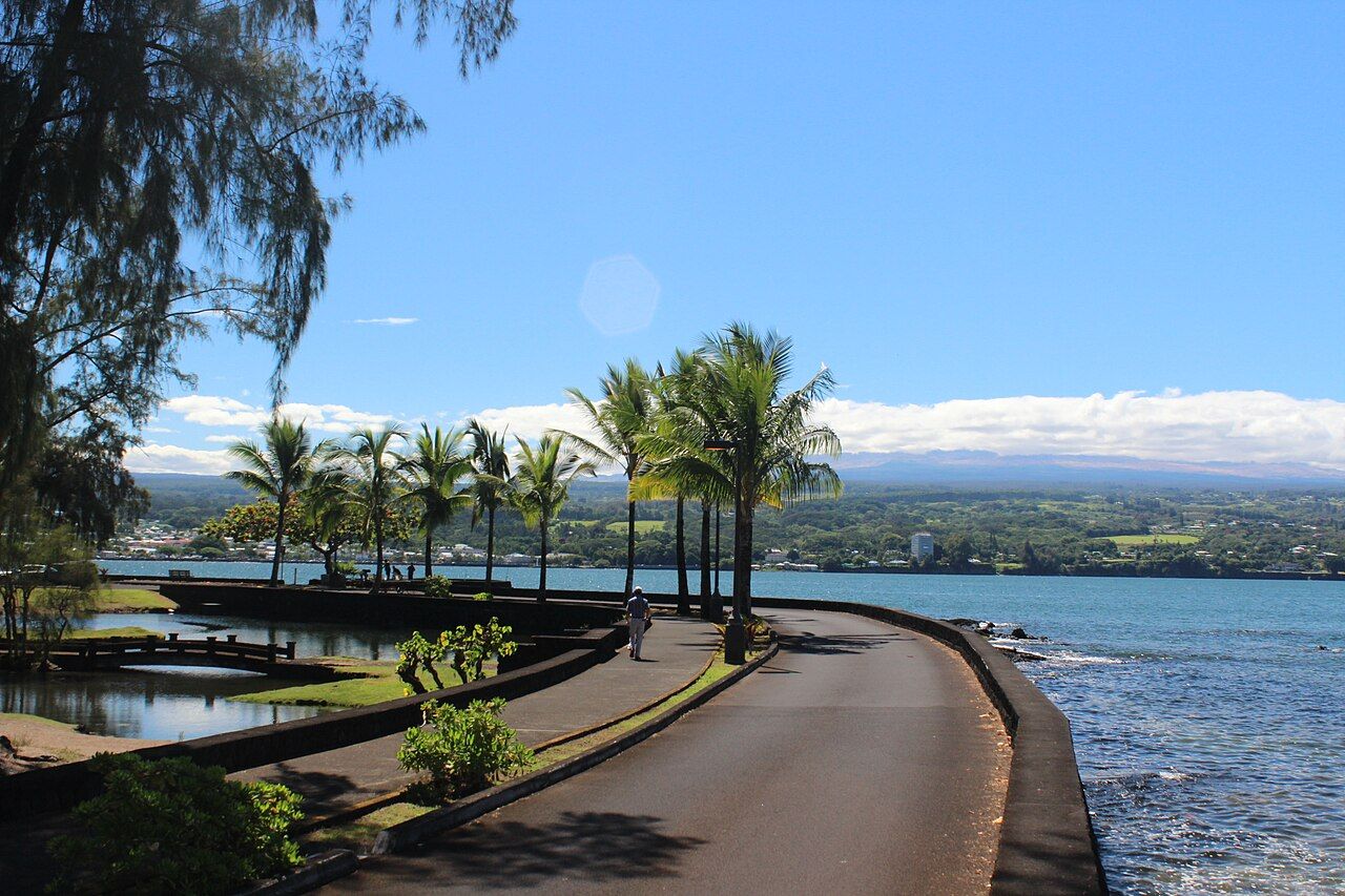

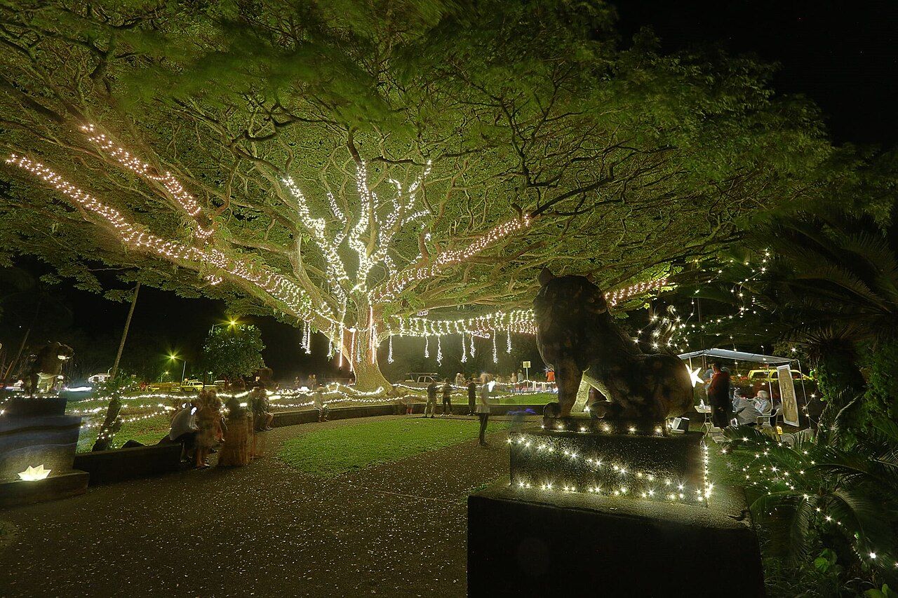
The gardens are especially quiet in the morning, and a picnic fits naturally into the slower pace. Around Christmas, lights are hung through the park after dark, when families stroll along the paths.

6. What lies just beyond the garden paths?
A footbridge reaches Mokuola, often called Coconut Island, just offshore. In Hawaiian tradition, the small island was a place of healing and refuge; now, locals swim, picnic and fish from its rocks, and children leap into the water from the edges.
It’s a park people use, and a place with history, so I like the balance of taking time there while leaving room for everyone else. Keep the place clean and be mindful of other people using it.
Nearby, Banyan Drive bends along the shore beneath huge banyan trees. Many were planted by well-known visitors during the twentieth century, and walking the loop brings shade and views over the bay.
7. When does Hilo get especially lively?
Each spring, the Merrie Monarch Festival brings a week of hula competition and celebration to town. Dancers and audiences come from across Hawaiʻi and beyond, and the main performances are famously hard to get tickets for.
Hilo gets busy during festival week, but the event isn’t confined to those performances; free events and the streets share in its spirit. That mix of a major gathering and ordinary town life is part of what makes Hilo feel like itself rather than a stage set.
8. What can the farmers market show?
Near downtown and the bayfront, Hilo’s farmers market is among the island’s busiest. Stalls carry tropical fruit, vegetables, flowers, baked goods, crafts and plants, with much of the produce grown on small farms in east Hawaiʻi.
The size of the market varies by day: some days bring more stalls and more choice. Arriving early helps with selection and sidesteps the midday heat. Small bills and a reusable bag make browsing easier.
Rambutan, lilikoʻi—which is passion fruit—and apple bananas are among the fruits to try. Vendors are often happy to explain how to eat something unfamiliar, and I like a market best when there’s time to ask and taste instead of rushing through with a checklist.
9. How does Hilo fit into a day from volcano country?
Hilo is a good contrast to the park’s cool forest and lava fields. A rainy morning in town can be followed by an evening back up in Volcano, or the day can go the other way when the summit is clear.
Waterfalls close to town make easy additions, including Rainbow Falls and ʻAkaka Falls. Hilo also opens the way toward Mauna Kea, the Hāmākua coast to the north and Puna to the south.
My favorite version of a Hilo day leaves space between stops: take a bayfront walk, linger in the gardens and let the rain set the rhythm. The town rewards looking around more than collecting a long list of sights.
10. What’s useful to keep together?
A few simple details help the outing fall into place:
- Hilo is just under an hour from volcano country, along Highway 11.
- Mornings are frequently clear; showers often get heavier in the afternoon and at night.
- Bring a light rain jacket and sandals or quick-drying shoes.
- Indoor stops can fill a wetter stretch of the day.
- A reusable bag and small bills are handy at the farmers market.
- For another shoreline story, carry on with the notes on Puna coast.